
Space Surveillance in the Digital Era: How Countries Track Increasingly Crowded Orbits

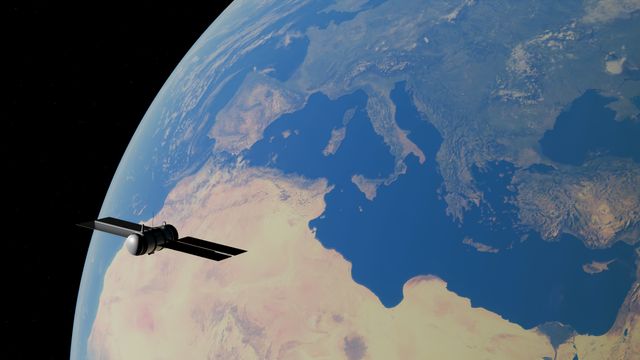

Earth’s orbital environment is becoming increasingly busy. Governments, commercial companies, research organisations and international institutions are placing more satellites into orbit to support communication, navigation, Earth observation, scientific research, weather monitoring and other applications. The rapid expansion of satellite constellations has created enormous opportunities, but it has also introduced a growing challenge: how can countries continuously understand what is happening in an increasingly crowded space environment?
Space surveillance has become an essential part of modern space operations. Countries need to know where satellites and other objects are located, how they are moving, and whether their predicted trajectories could create a risk of collision. Tracking is also important for understanding inactive satellites, spent rocket stages and fragments created by previous space activities. As the number of objects increases, maintaining an accurate picture of the orbital environment becomes more technically demanding.
The digital era is transforming this field. Traditional radar and optical telescopes remain fundamental, but modern space surveillance increasingly combines these systems with high-performance computing, artificial intelligence, automated data processing, satellite-based sensors and international information sharing. The result is an evolving global effort to create a more accurate and continuously updated picture of activity around Earth.
Why Earth’s Orbits Are Becoming More Crowded
The number of satellites in orbit has increased dramatically as access to space has become more affordable and commercial satellite technology has advanced. Smaller spacecraft can now be manufactured relatively quickly, while reusable launch systems and rideshare missions have reduced some of the barriers associated with reaching orbit.
Large satellite constellations have accelerated this trend. Instead of deploying a small number of large spacecraft, companies can operate networks containing hundreds or thousands of satellites. These constellations can provide broadband connectivity, Earth imaging, navigation-related services and other capabilities across large geographical areas.
This growth brings substantial benefits. Satellite networks can connect remote communities, provide information during disasters, improve weather forecasting and support scientific research. At the same time, every additional spacecraft contributes to the complexity of the orbital environment.
The challenge becomes particularly significant when satellites operate in similar orbital regions. A collision between two spacecraft can create thousands of fragments, potentially increasing the risk to other satellites. This cascading effect is one reason space agencies and commercial operators place increasing emphasis on tracking and collision avoidance.
What Is Space Surveillance?
Space surveillance refers broadly to the observation, detection, identification and tracking of objects in space. These objects can include active satellites, inactive spacecraft, rocket bodies and fragments of space debris.
A surveillance system attempts to answer several fundamental questions. What objects are currently in orbit? Where are they located? How fast are they moving? What direction are they travelling? How is their orbit changing? And could their predicted paths bring them dangerously close to another spacecraft?
The answers are not static. Satellites are constantly moving around Earth, and their trajectories can be affected by atmospheric drag, gravitational influences, solar radiation pressure and intentional orbital manoeuvres.
This means space surveillance is not simply about creating a catalogue of objects. It requires continuous observation and repeated calculation to maintain accurate predictions of where those objects will be in the future.
Radar: A Core Technology for Orbital Tracking
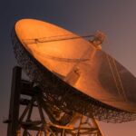
Radar remains one of the most important technologies used for space surveillance. Ground-based radar systems transmit radio signals toward objects in space and analyse the signals that return.
Because radar can operate during both day and night and does not depend on visible sunlight, it is particularly useful for tracking objects under a wide range of conditions. Advanced radar systems can detect relatively small objects and determine information about their position and movement.
Different radar systems have different capabilities. Some are designed primarily to detect objects over large areas, while others can provide more detailed tracking of specific objects.
The data generated by radar observations can be combined with information from other sensors to improve orbital predictions. When observations from multiple systems are brought together, analysts can develop a more comprehensive understanding of an object’s trajectory.
Optical Telescopes and Space-Based Observation
Optical sensors provide another major source of information. Telescopes can observe satellites and debris by detecting sunlight reflected from their surfaces. Optical tracking can be particularly valuable for objects that are difficult to observe using certain radar systems.
Ground-based telescopes can also provide observations across different geographic locations, increasing the chances of observing objects under favourable conditions. Space-based sensors add another layer of capability. Placing sensors in orbit can provide perspectives that are difficult to obtain from the ground.
Space-based observation systems can monitor objects in regions where atmospheric conditions or geographical limitations make ground observation challenging. Combining radar, optical and space-based observations creates a more resilient surveillance architecture than relying on a single sensor type.
The Role of Digital Data Processing
Modern space surveillance generates enormous amounts of data. A single sensor may produce observations containing information about an object’s location, velocity, brightness and movement. When observations from many sensors are combined, the volume and complexity increase significantly.
Digital computing is therefore essential. Software systems process observations, compare them against existing orbital catalogues and estimate the trajectories of tracked objects. Data processing also helps determine whether a new observation corresponds to an object that is already known or represents a previously untracked object.
Correct identification is important because inaccurate object associations can lead to incorrect orbital predictions. Modern systems increasingly automate these processes. Automated algorithms can rapidly compare observations, update orbital estimates and flag objects that require additional attention.
Artificial Intelligence and Space Surveillance
Artificial intelligence and machine learning are increasingly being explored for space-domain awareness. AI can help analyse large datasets and identify patterns that might be difficult to detect through manual analysis alone.
Machine learning systems can potentially improve the classification of objects based on sensor observations. They can also support anomaly detection by identifying movements or behaviours that differ from expected patterns.
Another potential application is improving conjunction analysis. A conjunction occurs when two space objects are predicted to pass sufficiently close to one another that a collision risk may exist. Determining the probability and severity of such an encounter requires analysing uncertainties in the predicted trajectories.
AI can assist analysts by processing large numbers of potential conjunctions and prioritising those that require closer examination.
However, artificial intelligence should not be viewed as a replacement for orbital mechanics and expert analysis. Space surveillance involves high-consequence decisions, and automated predictions require validation. A sophisticated algorithm is useful only when the underlying observations, models and assumptions are reliable.
Tracking Space Debris
One of the most difficult problems facing space surveillance is orbital debris. Space debris includes inactive satellites, fragments from collisions, discarded rocket stages and other human-made objects that remain in orbit. Even relatively small fragments can pose serious risks because orbital velocities are extremely high.
A small piece of debris can damage or destroy a functioning spacecraft during a collision. The difficulty is that not all debris can be tracked equally well. Larger objects are generally easier to detect, while smaller fragments can be much more difficult to observe consistently.
This creates an important challenge for collision avoidance. A spacecraft operator may receive accurate information about a large object while having less certainty about smaller pieces of debris. Better sensors and improved data-processing techniques are therefore essential for increasing the quality of orbital awareness.
Collision Avoidance in an Increasingly Crowded Environment
As orbital traffic increases, collision avoidance becomes an increasingly important operational activity. Satellite operators need timely information about potential close approaches so that they can determine whether a manoeuvre is necessary.
The process typically involves monitoring the predicted trajectories of objects and calculating whether their paths could converge. If the probability of collision becomes sufficiently concerning, operators may evaluate possible manoeuvres. Such decisions are not simple. Moving a satellite requires fuel and can interfere with its mission.
A poorly planned manoeuvre could potentially create a new conflict with another object. This makes accurate surveillance essential. The better the available information about the location and trajectory of objects, the more effectively operators can make decisions about whether and how to manoeuvre.
Space Situational Awareness and Space Domain Awareness
The concept of space surveillance is increasingly connected with the broader idea of space situational awareness and space domain awareness.
Space situational awareness traditionally focuses strongly on understanding the physical environment around Earth, including satellites, debris and natural phenomena. Space domain awareness can encompass a wider understanding of objects, activities and behaviours in space.
The distinction matters because the modern space environment is no longer purely scientific or commercial. Satellites support communications, navigation, intelligence, weather services, financial systems and national security infrastructure. Consequently, countries increasingly view knowledge of the orbital environment as a strategic capability.
Why Countries Build Their Own Tracking Networks
Countries have strong incentives to develop independent space surveillance capabilities. Reliable knowledge of objects in orbit can protect national satellites and support the safety of commercial and scientific spacecraft. National systems can also provide information that may not always be available through international networks.
Independent tracking capabilities can improve a country’s ability to respond to conjunctions, investigate unexpected orbital events and maintain awareness of activities involving important spacecraft.
The United States operates one of the world’s most extensive space surveillance infrastructures, while other space powers and space agencies have developed their own radar and optical observation capabilities. India has also expanded its space situational awareness capabilities through initiatives involving the Indian Space Research Organisation and other national institutions.
India’s Network for Space Objects Tracking and Analysis, commonly known as NETRA, is intended to strengthen the country’s ability to monitor objects and debris in orbit. These capabilities are increasingly relevant as India’s satellite programmes, commercial space sector and launch activities continue to grow.
International Cooperation in Orbital Tracking
Although national surveillance capabilities are important, no country can easily maintain complete visibility of every object in space by itself. Objects move across national boundaries and can remain in orbit for years or decades. A satellite launched by one country can pass over another country’s territory multiple times each day.
Consequently, space surveillance naturally creates incentives for international cooperation. Countries, space agencies, commercial operators and international organisations can share observations, orbital information and collision warnings. Such cooperation can improve the accuracy of tracking and reduce duplication of effort.
Commercial space companies are also becoming increasingly important participants. Private firms operate large constellations and therefore have a direct interest in accurate orbital information. The future of space safety is likely to depend on a combination of government systems, commercial tracking networks and international information-sharing frameworks.
The Challenge of Orbital Prediction
Tracking an object today does not guarantee that its future location can be predicted perfectly. Orbital predictions contain uncertainty. For satellites in low Earth orbit, atmospheric drag can significantly influence their trajectories. The density of the upper atmosphere changes with solar activity, making long-term predictions more difficult.
Other forces can also affect spacecraft. Earth’s gravitational field is not perfectly uniform, and the gravitational influence of the Moon and Sun can contribute to orbital changes. Solar radiation pressure can also influence certain spacecraft, particularly those with large surface areas relative to their mass.
As a result, orbital predictions become increasingly uncertain as the prediction window grows. Space surveillance systems must therefore continuously update their calculations as new observations become available.
The Importance of Data Standards
With many countries and companies generating orbital data, interoperability becomes critical. Different organisations may collect information using different sensors, formats and processing methods.
Standardised data formats and communication protocols can make it easier to share information and compare observations. This becomes particularly important during potential collision events, when delays or misunderstandings can increase operational risk.
The growth of commercial space situational awareness services makes this issue even more significant. Operators may receive conjunction information from multiple sources and need to determine how the information relates to their own tracking systems. Better standards can help create a more connected orbital information ecosystem.
Cybersecurity and Digital Space Surveillance
As space surveillance becomes increasingly digital, cybersecurity becomes another important consideration. Tracking networks rely on computers, communication systems, databases and software.
If these systems are compromised, inaccurate information could potentially be introduced into the tracking process. An attacker might attempt to manipulate orbital information, disrupt communications or interfere with the availability of surveillance services.
This makes cybersecurity a fundamental part of space safety. Protecting the physical sensors is not enough. The digital infrastructure that processes and distributes orbital information must also be secured.
The issue is particularly important because modern societies increasingly depend on satellites. A disruption to satellite communications, navigation or Earth observation can affect activities far beyond the space sector.
Commercial Satellites and the Future of Orbital Management
The rapid expansion of commercial satellite constellations is likely to remain one of the most important factors shaping space surveillance.
Large constellations can provide significant social and economic benefits, but their scale requires operators to develop sophisticated systems for automated tracking and collision avoidance.
The future orbital environment may therefore depend increasingly on autonomous systems that can continuously monitor thousands of spacecraft and respond to changing conditions.
Automation could reduce the workload for human operators, but it also introduces questions about responsibility. If an automated system recommends or performs a manoeuvre, operators need to understand how the decision was made and ensure that safeguards exist.
The challenge will be to combine automation with human oversight rather than choosing one over the other.
The Future of Space Surveillance
Space surveillance is likely to become increasingly intelligent, distributed and automated. Future networks could combine ground-based radar, optical telescopes, space-based sensors, commercial observation systems and satellite telemetry into integrated platforms.
Artificial intelligence could help identify objects, estimate trajectories and prioritise potential collision risks. Cloud computing and high-performance computing could allow massive datasets to be processed rapidly.
Digital twins may eventually provide continuously updated virtual representations of important orbital environments. These models could simulate possible future trajectories and help operators understand the consequences of proposed manoeuvres.
The long-term objective is not simply to track more objects. It is to develop a sufficiently accurate understanding of the space environment that satellites can operate safely even as orbital traffic continues to grow.
Conclusion
Space is no longer an environment where only a relatively small number of government spacecraft operate. Commercial constellations, scientific missions, communication satellites and other spacecraft are creating an increasingly complex orbital ecosystem.
Space surveillance has therefore become a critical part of modern space infrastructure. Radar, optical telescopes, space-based sensors and advanced digital systems allow countries and satellite operators to monitor objects and predict their movements. Artificial intelligence and automated data processing are adding new capabilities by helping organisations analyse enormous quantities of information more quickly.
Yet technology alone cannot solve every challenge. Orbital predictions remain uncertain, small debris can be difficult to detect, data must be shared effectively, and cybersecurity must protect the digital infrastructure behind surveillance systems. International cooperation will also become increasingly important because the orbital environment is shared by all spacefaring nations.
As the number of satellites continues to increase, the ability to understand and manage orbital traffic will become just as important as the ability to launch spacecraft. The future of space exploration and satellite services will depend not only on reaching orbit, but also on keeping that environment observable, predictable and safe.
Online Internship with Certificate
You may be interested

UPI and Merchant Charges: Why Traders Are Calling for “No UPI Day”
Anshika Jain - Oct 05, 2026India’s Unified Payments Interface has transformed the way people pay for goods and services. From roadside vendors and neighbourhood grocery stores to large retailers, restaurants and online…

Flydubai Flight Incident: How an Injured Captain Helped Regain Control of the Aircraft
Anshika Jain - Oct 05, 2026The Flydubai Flight FZ1073 incident has drawn international attention after an in-flight cockpit confrontation left the aircraft in a dangerous descent and seriously injured its Indian captain,…

Delhi’s New AI-Powered Pollution Control Centre: How AI Track Pollution Sources
Anshika Jain - Oct 05, 2026Delhi’s air pollution problem has long been one of the most difficult environmental challenges in India. Every year, especially as winter approaches, a combination of vehicle emissions,…
Most from this category

BHU Women’s Safety Protests: Why Students Are Challenging Campus Curfew Rules
Anshika Jain - Oct 05, 2026
Why Tracking Satellites Has Become a Strategic Technology for Modern Nations
Anshika Jain - Oct 02, 2026
Can AI Help Cities Identify Pollution Sources Before They Become Public-Health Emergencies?
Anshika Jain - Oct 02, 2026

BHU Women’s Safety Protests: Why Students Are Challenging Campus Curfew Rules
Anshika Jain - Oct 05, 2026Why Tracking Satellites Has Become a Strategic Technology for Modern Nations
Anshika Jain - Oct 02, 2026Can AI Help Cities Identify Pollution Sources Before They Become Public-Health Emergencies?
Anshika Jain - Oct 02, 2026