

Railway Safety in Landslide-Prone Regions: Role of Sensors and Early-Warning Systems

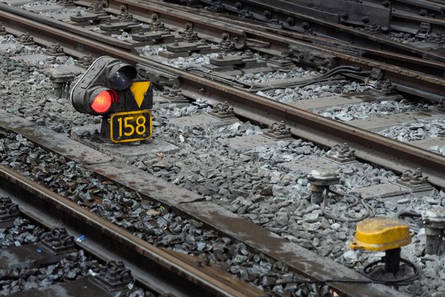

Railway networks that pass through mountainous terrain are essential for connecting remote communities, supporting tourism, transporting goods and strengthening regional economies. However, these routes often operate in landscapes where steep slopes, unstable geological formations, intense rainfall, weathering and human activities create persistent landslide risks. A landslide near a railway line can bury tracks under debris, damage bridges and tunnels, destabilise embankments or leave sections of track unsupported. Even a relatively small slope failure can interrupt services, damage railway infrastructure and place passengers and railway personnel in danger.
Traditional railway safety systems rely heavily on track inspections, weather monitoring, maintenance reports and visual observations by railway staff. These measures remain important, but they may not provide enough warning when a slope begins moving rapidly or when heavy rainfall triggers a sudden collapse. Modern monitoring technologies offer an opportunity to identify developing hazards earlier by observing changes in the ground, measuring environmental conditions and connecting these measurements to operational decisions.
The integration of ground-based sensors, satellite remote sensing, artificial intelligence and early-warning systems is creating a more comprehensive approach to railway safety in landslide-prone regions. Rather than depending on a single inspection or measurement, railway authorities can combine information from different sources to understand slope behaviour, identify vulnerable sections and determine when train operations may need to be restricted. Research on remote sensing and railway geohazards highlights the value of integrating satellite observations with ground measurements and local monitoring systems.
The objective is not simply to predict every landslide accurately, which remains technically difficult, but to reduce uncertainty, improve response time and prevent trains from entering dangerous sections of track.
Understanding the Landslide Threat to Railway Infrastructure
Why Mountain Railway Corridors Are Vulnerable
Railway lines in mountainous areas frequently cut through natural slopes or run alongside hillsides, rivers and valleys. Construction may require tunnels, rock cuttings, retaining walls, embankments and drainage channels. Although these structures make railway transport possible across difficult terrain, they can also alter the natural movement of water and the stability of surrounding soil and rock.
During prolonged rainfall, water can infiltrate the ground, increase pore-water pressure and reduce the friction that helps soil and rock remain stable. Water may also accumulate behind retaining structures, erode the base of a slope or wash away material supporting a railway embankment. In other situations, earthquakes, freeze-thaw processes, weathering, excavation or changes in vegetation can contribute to instability. A slope may remain apparently stable for long periods before movement accelerates under particular environmental conditions.
The resulting hazards vary in scale and speed. Slow-moving landslides may produce gradual ground deformation over weeks or months, creating opportunities for monitoring and maintenance. Rapid debris flows and rockfalls, however, may reach railway tracks with little time for intervention. Railway safety systems therefore need to monitor both long-term changes and sudden events.
How Landslides Affect Train Operations
A landslide can affect railway safety even when the main track structure initially appears intact. Debris may obstruct the rails, damage signalling equipment or block drainage systems. Ground movement can distort track alignment, change the geometry of embankments or undermine foundations supporting bridges and tunnel entrances. In severe cases, the track may become suspended over an eroded section or shift away from its intended position.
The consequences extend beyond immediate physical damage. Train services may require emergency suspension, passengers may become stranded, freight deliveries may be delayed and repair costs may rise substantially. Repeated disruptions can also affect local businesses and communities that depend on reliable railway connections.
For this reason, railway risk assessment should not focus exclusively on whether a landslide is likely to occur. It must also evaluate how close the unstable area is to the track, how quickly the material could reach railway infrastructure, whether alternative routes exist and how much time is available to stop or divert trains.
Ground-Based Sensors: Detecting Changes Before Failure
Rainfall and Weather Monitoring Sensors
Rainfall is a major trigger for many landslides, making accurate precipitation monitoring a central component of railway risk management. Automatic rain gauges installed near vulnerable slopes can measure rainfall intensity, duration and accumulated precipitation. These measurements help railway engineers assess whether current weather conditions are approaching levels associated with previous slope failures.
A rainfall threshold is not a universal number that applies to every mountain. The amount of rainfall needed to destabilise a slope depends on soil composition, geological structure, drainage, vegetation, slope angle and the amount of water already present in the ground. A location that has experienced several days of rainfall may respond differently to a short, intense storm than a relatively dry slope exposed to the same rainfall intensity.
Monitoring systems can therefore combine local rainfall observations with historical landslide records and site-specific geological assessments. When rainfall reaches predefined thresholds, the system can trigger additional inspections, increase monitoring frequency or recommend operational restrictions. Rainfall should be treated as an indicator of changing risk rather than proof that a landslide will occur.
Soil Moisture and Pore-Water Pressure Sensors
Rainfall measurements describe water entering the environment, but they do not fully reveal how much water has accumulated inside a slope. Soil moisture sensors help measure the water content of the ground, while piezometers monitor groundwater levels or pore-water pressure at selected depths. These measurements provide information about the internal conditions that can influence slope stability.
A rise in pore-water pressure may reduce the effective stress holding soil particles together, increasing the possibility of movement under otherwise similar conditions. By placing sensors at different depths, engineers can investigate how quickly rainfall penetrates a slope and whether water is accumulating near a potential failure surface.
These instruments are particularly useful where geological investigations have identified vulnerable soil layers, seepage zones or groundwater-related instability. Their effectiveness depends on correct installation, calibration and maintenance. A sensor positioned in an unrepresentative part of a slope may provide measurements that do not reflect the conditions affecting the railway corridor.
Inclinometers, Crack Sensors and Ground Movement Instruments
Rainfall and groundwater measurements indicate conditions that may contribute to instability, whereas deformation sensors can measure physical changes in the slope itself. Inclinometers can detect changes in the inclination of a borehole casing, helping engineers identify movement at particular depths. Crack gauges can measure the widening or narrowing of fractures in rock, retaining walls and other structures. Surveying instruments and Global Navigation Satellite System receivers can measure the movement of selected ground points over time.
These measurements can reveal whether a slope is stable, moving gradually or undergoing accelerating deformation. A combination of increasing displacement, rising groundwater pressure and persistent rainfall may provide stronger evidence of growing instability than any individual measurement.
However, not all landslides exhibit clear or gradual warning signs. Some rockfalls occur suddenly, and some failures develop in areas where instrumentation is sparse. Ground-based sensors should therefore be selected according to the local failure mechanism rather than installed according to a uniform template across every railway section.
Satellite Data: Monitoring Large and Remote Railway Corridors
Satellite Imagery for Landslide Mapping
Satellite observations provide a broad view of terrain that may be difficult or expensive to inspect continuously from the ground. Optical satellite imagery can help identify landslide scars, exposed soil, changes in vegetation, drainage patterns and alterations to hillsides near railway infrastructure. Repeated images can reveal how a slope changes over time, while digital elevation models provide information about terrain elevation, slope steepness and the shape of valleys.
This information supports landslide susceptibility mapping, which identifies locations where geological and environmental conditions make slope failure more likely. Railway authorities can combine terrain data with records of previous landslides, rainfall patterns, geological maps and the location of tracks, bridges, tunnels and stations to prioritise areas for detailed investigation.
In India, the Indian Space Research Organisation’s National Remote Sensing Centre has developed the Landslide Atlas of India, which documents landslide locations across vulnerable regions and includes seasonal, event-based and route-wise inventories. Such datasets can help planners understand the distribution of landslide hazards and identify railway corridors that may require closer monitoring.
Optical imagery nevertheless has limitations. Thick cloud cover during monsoon conditions can prevent satellites from obtaining clear views precisely when landslide risk is elevated. Vegetation may conceal small slope changes, and a satellite image acquired after an event cannot by itself provide a continuous real-time warning. For these reasons, optical imagery is most effective when combined with other observation methods.
Interferometric Synthetic Aperture Radar
One of the most promising technologies for monitoring slow ground movement is Interferometric Synthetic Aperture Radar, commonly known as InSAR. It uses radar observations collected at different times to identify changes in the distance between the satellite and the ground. Under suitable conditions, these observations can reveal subtle surface deformation that may not be visible in conventional photographs.
For railway corridors, InSAR can help identify slopes that are gradually moving, areas experiencing settlement and sections of infrastructure affected by persistent ground deformation. Instead of restricting surveillance to a few instrumented locations, satellite radar can assess extensive areas and help engineers determine where more detailed ground investigations are necessary.
The technique has been widely studied for landslide detection and infrastructure monitoring. Its value is particularly strong when repeated observations are analysed over time and compared with ground-based measurements. A 2023 review of remote-sensing methods for landslide detection and prediction describes how satellite observations, ground-based radar, laser scanning and other techniques can complement one another in hazard assessment.
InSAR is not a universal solution. Dense vegetation, snow, rapid surface changes and atmospheric disturbances can affect measurement quality. Satellite revisit intervals may also be too long to capture a rapidly developing failure in time for an immediate warning. Furthermore, the measured displacement represents movement in the satellite’s viewing direction and may not fully describe the three-dimensional motion of a slope.
The most effective approach is to use satellite radar for wide-area surveillance and long-term trend analysis, while relying on ground instruments and rapid-response systems for detailed monitoring at critical locations.
Combining Satellite and Ground Observations
Satellite data becomes more operationally useful when it is connected to railway engineering records and local sensor measurements. A satellite may identify gradual movement across a hillside, while an inclinometer reveals deformation at depth and a rain gauge records an intense storm. Together, these observations can help engineers investigate whether the movement is associated with rainfall, groundwater changes or another mechanism.
Satellite-based monitoring can also guide the placement of expensive sensors. Rather than installing instruments along every kilometre of track, railway authorities can prioritise locations where remote sensing identifies unusual deformation or where historical records indicate repeated slope failures. Field investigations can then establish the geological conditions and determine the appropriate monitoring strategy.
The United States Federal Railroad Administration has investigated the use of InSAR and the Small Baseline Subset method to identify areas along railway rights-of-way that may be susceptible to rockfall and other slope-related hazards. This illustrates how satellite deformation analysis can support railway-specific hazard screening, although such screening does not guarantee that a particular failure can be predicted.
Early-Warning Systems: Turning Measurements Into Safety Decisions
How an Integrated Warning System Works
An early-warning system is more than a collection of sensors. It must connect observations to risk assessment, communication and an appropriate response. The process begins with data collection from weather stations, soil moisture sensors, groundwater instruments, deformation monitors, satellite products and railway inspections. These inputs are checked for quality and compared with site-specific thresholds or analytical models.
When measurements indicate a possible increase in danger, the system evaluates the significance of the change. A warning may be triggered by rainfall exceeding a locally established threshold, accelerating slope movement, a sudden change in groundwater pressure or several indicators occurring together. The system then communicates the result to the designated railway control centre, engineering teams and other responsible authorities.
The final stage is operational action. Depending on the severity and reliability of the warning, this may involve dispatching inspection teams, reducing train speed, imposing a temporary block on the affected section, stopping trains before they enter the danger zone or arranging emergency maintenance. The exact response should follow approved railway safety procedures and the authority of designated personnel.
The purpose of the system is to create enough time for protective action. An accurate warning that arrives after a train has entered a hazardous section may have little practical value. Equally, an alert that does not reach the control centre or is not connected to a clear response procedure cannot reliably improve safety.
Risk Thresholds and Warning Levels
A practical system may use graduated warning levels that correspond to different combinations of environmental conditions and observed movement. An initial advisory could indicate that rainfall or soil moisture is increasing and that monitoring should be intensified. A higher-level warning could be issued when deformation accelerates or multiple indicators suggest an elevated probability of failure. A critical warning could require immediate inspection or suspension of train movement in accordance with railway rules.
These levels must be developed for individual sites or groups of comparable sites. Thresholds based on historical events can be useful, but they should be reviewed when new measurements, geological investigations or failure records become available. A threshold that works for one slope may perform poorly on another because the ground materials and drainage conditions differ.
Warning design must also balance missed events against false alarms. If the system fails to warn about a dangerous slope, the consequences can be severe. If it repeatedly issues warnings when no dangerous event follows, staff may become less responsive and service disruptions may increase. Regular validation, transparent alert criteria and documented human review are therefore essential.
Communicating Warnings Across Railway Operations
The effectiveness of early warning depends on communication reliability. Alerts must reach control rooms even during heavy rainfall, power interruptions, damaged telecommunications infrastructure or local network outages. Remote monitoring stations may need backup power, redundant communication channels and the ability to store observations temporarily when connectivity fails.
Warnings should identify the affected railway section, the type of hazard, the time of the latest observation, the level of confidence and the recommended action. General messages such as “landslide risk high” are less useful than alerts that clearly identify the relevant track location and the operational decision required.
Coordination with meteorological agencies, disaster-management authorities, local administrations and emergency services is also important. A landslide may affect a railway line, a nearby road, a river channel and settlements at the same time. Shared information can help authorities coordinate closures, rescue operations, inspections and public communication.
Artificial Intelligence and Predictive Risk Assessment
Identifying Patterns Across Multiple Data Sources
Artificial intelligence can help analyse the large and varied datasets generated by railway monitoring systems. Machine-learning models can examine rainfall histories, soil moisture, groundwater pressure, slope displacement, satellite deformation measurements and past landslide records to identify combinations of conditions associated with elevated risk.
For example, a model might learn that a particular slope becomes more unstable after sustained rainfall when groundwater levels are already high. Another may identify recurring deformation patterns near tunnel entrances or railway cuttings. These insights can help engineers prioritise inspections and allocate monitoring resources to locations where additional attention is most valuable.
However, the predictive performance of such models depends on the quality and representativeness of the data used to train them. Landslides that directly affect railway lines may be relatively rare compared with the number of ordinary days on which sensors collect measurements. Historical records may also be incomplete, particularly for small events that were not formally documented. A model trained on one geological region may not transfer reliably to a different region with different soil, rainfall and slope conditions.
For this reason, artificial intelligence should support, rather than replace, geotechnical expertise and established railway safety procedures. Models should be tested against historical events, evaluated under different environmental conditions and updated as new evidence becomes available. Their predictions should include uncertainty and should not be presented as guarantees that a landslide will or will not occur.
Digital Twins for Railway Hazard Management
A railway digital twin is a digital representation of a physical railway asset and its surrounding environment. In a landslide-prone corridor, this representation can combine terrain models, track geometry, retaining structures, drainage systems, geological information, sensor readings and satellite observations.
When new data arrives, the digital representation can be updated to show changes in slope movement or infrastructure condition. Engineers may then examine how a developing hazard could affect a specific track segment, bridge approach or tunnel portal. A digital twin may also help compare potential responses, such as increasing inspections, improving drainage or restricting traffic during a high-risk period.
Recent research has explored integrated railway monitoring architectures that combine satellite radar, laser scanning, optical imagery and other data sources to generate segment-level assessments of ground-related hazards. Such systems demonstrate the potential of integrating different observation methods into a common analytical environment, although their operational effectiveness must be validated for each deployment.
The practical value of a digital twin depends on data quality, interoperability and maintenance. An outdated terrain model or incorrectly located sensor can produce misleading assessments. Digital models must therefore be connected to verified asset records, updated through field inspections and designed to communicate uncertainty clearly.
Railway Landslide Safety in India
India’s railway network includes routes through the Himalayas, the northeastern hills and other regions exposed to landslides, intense monsoon rainfall and complex terrain. These conditions create a need for safety strategies that combine engineering protection, weather monitoring, remote sensing and operational preparedness.
The Indian Space Research Organisation’s landslide mapping resources provide a foundation for identifying vulnerable areas, while the Geological Survey of India is working towards regional landslide early-warning capabilities using geoscientific information, remote sensing, weather-related inputs and predictive risk analysis. These initiatives can contribute to broader hazard awareness and support the identification of locations requiring more detailed monitoring.
For railway applications, the information must be translated into corridor-specific decisions. A regional landslide forecast may indicate that a district faces elevated risk, but railway engineers still need to determine which track sections are exposed, whether unstable slopes can reach the line and what protective measures are appropriate. The distance between a slope and the track, local drainage patterns, terrain geometry and the condition of existing infrastructure all influence the level of railway risk.
A practical deployment strategy would begin with an inventory of historical landslides and vulnerable railway assets. Satellite imagery and terrain analysis could be used to screen the wider corridor, followed by geological investigations at priority locations. Rainfall gauges, groundwater sensors and deformation instruments could then be installed where they provide meaningful information about the identified failure mechanisms. The resulting warnings would need to be connected to railway control rooms, inspection teams and approved procedures for restricting train movement.
India’s varied terrain also means that a single technical model is unlikely to suit every route. Systems designed for a rocky Himalayan cutting may need different sensors and thresholds from those used near a waterlogged embankment or a slope covered in dense vegetation. Local calibration and continuous field validation are essential for reliable deployment.
Challenges in Implementing Integrated Monitoring Systems
Difficult Terrain and Unreliable Connectivity
Remote railway corridors can be difficult to access, making sensor installation, maintenance and calibration expensive. Landslides themselves may damage communication cables, power supplies and access roads, precisely when monitoring information becomes most important. Equipment must therefore be selected for local weather conditions and designed to continue operating during disruptions wherever feasible.
Solar power, battery backup, redundant communications and local data storage can improve resilience, but they increase installation and maintenance requirements. Railway authorities must also establish responsibility for checking sensor performance, replacing damaged equipment and investigating unexplained changes in readings.
Data Quality and Interpretation
Different monitoring technologies measure different physical properties. A satellite may record surface displacement across a broad area, while a borehole instrument measures movement at a particular depth and a rain gauge records precipitation at a single location. These observations cannot simply be combined without accounting for their spatial coverage, measurement frequency, uncertainty and potential errors.
Data-processing systems must preserve the time and location of each measurement and distinguish between missing data, instrument failure and genuine environmental changes. Otherwise, a faulty sensor or an incorrectly aligned dataset could create a false warning or conceal a developing hazard.
Costs, False Alarms and Operational Coordination
Advanced monitoring requires investment in instruments, data infrastructure, skilled personnel, communications and long-term maintenance. Limited budgets may make it impractical to instrument every vulnerable slope continuously. Risk-based deployment can help direct resources towards locations where a failure would have the greatest potential consequences.
False alarms present a separate operational challenge. Frequent closures can disrupt passenger services and freight movements, while weak warning criteria can leave railway operations exposed to avoidable danger. Systems should therefore be evaluated not only by how accurately they identify hazards but also by how much useful warning time they provide, how reliably alerts reach decision-makers and whether recommended actions are followed.
Clear accountability is critical. Monitoring agencies may detect a change, engineers may interpret the measurements and railway controllers may implement operational restrictions. These responsibilities should be established in advance so that uncertainty does not lead to delayed action during an emergency.
The Future of Predictive Railway Safety
The next stage of railway landslide management will likely involve closer integration of satellite monitoring, ground sensors, weather forecasts, railway inspection systems and automated risk analysis. Instead of treating each technology as a separate service, authorities can build connected monitoring frameworks that maintain a continuous picture of vulnerable corridor sections.
Improved satellite revisit capabilities, more reliable ground-based radar, low-power wireless sensors and increasingly capable analytical models may strengthen the detection of subtle changes. Automated systems could prioritise unusual measurements, identify locations requiring field inspection and present engineers with a clearer history of changing conditions. Digital twins could connect these findings to track geometry, asset condition and planned maintenance.
Yet technological progress alone will not make railway corridors safe. Predictive systems require reliable observations, site-specific engineering knowledge, tested warning procedures and personnel trained to respond to alerts. They must also be designed to fail safely, with contingency arrangements for missing data, equipment damage and communication outages.
A mature safety framework will combine preventive engineering with monitoring and emergency readiness. Slope drainage, retaining structures, rockfall barriers, vegetation management where appropriate and regular infrastructure inspections remain important. Sensors and satellite data add the ability to observe changing conditions, while early-warning procedures turn those observations into timely operational decisions.
Conclusion
Railway safety in landslide-prone regions requires a shift from periodic inspection alone towards continuous, evidence-based risk management. Ground-based sensors can measure rainfall, groundwater conditions and physical deformation. Satellite imagery and InSAR can help identify vulnerable slopes and monitor ground movement across extensive railway corridors. Artificial intelligence and digital twins can bring these observations together, while early-warning systems can connect emerging risks to inspections, speed restrictions and emergency closures.
No individual technology can reliably predict every landslide or eliminate geological uncertainty. The greatest benefit comes from combining complementary methods, calibrating them to local conditions and ensuring that warnings lead to clear, timely action. For railway networks operating through mountains and unstable terrain, this integrated approach can improve situational awareness, support more targeted maintenance and reduce the likelihood that trains encounter dangerous conditions without adequate warning.
The future of railway safety will depend not simply on collecting more data, but on transforming that data into dependable decisions. When satellite observations, ground sensors, engineering expertise and operational procedures work together, railway authorities are better equipped to protect passengers, railway personnel and critical transport infrastructure.
Online Internship with Certificate
You may be interested

AI in Police Investigations: Automated Risk Scores Introduce Bias Into Law Enforcement
Anshika Jain - Oct 26, 2026Artificial intelligence is becoming an increasingly important part of modern law enforcement. Police departments and investigative agencies can use AI-powered tools to analyse large volumes of records,…

Can Synthetic Media Influence Elections? Challenges of Detecting Manipulated Political Content
Anshika Jain - Oct 26, 2026Elections depend on more than voting machines, polling stations, and ballot counting. They also depend on the information voters receive before making their decisions. Political speeches, interviews,…

Who Is Liable When an AI System Makes a False Accusation?
Anshika Jain - Oct 26, 2026Artificial intelligence is increasingly being used to identify suspicious transactions, detect potential fraud, monitor workplace activity, evaluate job applicants, support law enforcement, and analyse online behaviour. These…
Most from this category

AI Voice Cloning Scams: How Can Families Verify an Emergency Call Before Sending Money?
Anshika Jain - Oct 26, 2026
Climate Adaptation Beyond Disaster Relief: Prevention Budgets Matter for Public Infrastructure
Anshika Jain - Oct 26, 2026

Women’s Safety After Dark: Why Street Design, Police Response Must Work Together
Anshika Jain - Oct 23, 2026
AI Voice Cloning Scams: How Can Families Verify an Emergency Call Before Sending Money?
Anshika Jain - Oct 26, 2026Climate Adaptation Beyond Disaster Relief: Prevention Budgets Matter for Public Infrastructure
Anshika Jain - Oct 26, 2026Why Do Heavy Rains Disrupt Transport Beyond the Monsoon Season?
Anshika Jain - Oct 23, 2026